






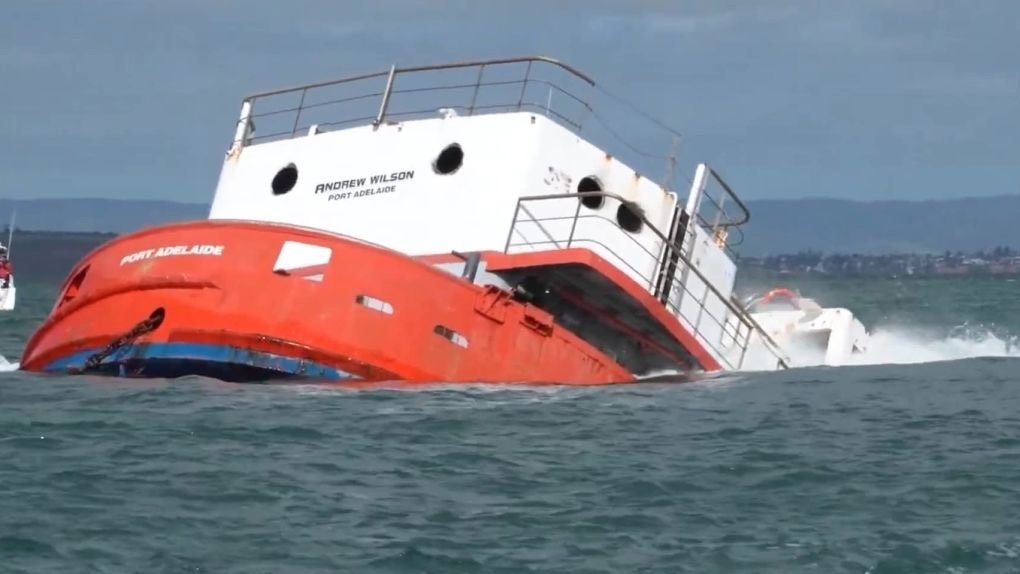
The MV Andrew Wilson has officially begun its second life, resting on the sandy floor of the St Vincent Gulf, six kilometres off the coast of Brighton. The 40-metre grab hopper dredger was scuttled this week, marking the first time in over two decades that a vessel has been purposely sunk in South Australian waters. This environmental landmark serves as a cornerstone of a $165 million government-led recovery initiative designed to restore marine biodiversity following severe algal blooms in the region.
## A Technical Marvel of Marine Restoration
The transformation of the 1962-built vessel into an artificial reef was a multi-month engineering operation. Donated by Maritime Constructions, the ship underwent an exhaustive decontamination process. Working alongside the Environment Protection Authority, specialist crews stripped the craft of all hazardous materials and performed a deep-clean to comply with stringent international environmental standards.
To ensure the vessel was ready for its new role, engineers cut strategic access points into the hull, allowing for safe passage for future divers. The ship’s interior—including the galley, engine room, and bridge—has been preserved as an underwater museum, while the iconic exterior crane remains intact to provide structural complexity for colonizing marine life. Resting at a depth of 20 metres, the site is perfectly positioned to cater to entry-level scuba divers, providing an accessible experience that balances adventure with environmental stewardship.
## The Intersection of Big Data and Marine Ecology
While the sinking of the MV Andrew Wilson represents a traditional approach to habitat restoration, modern marine conservation is increasingly reliant on the sophisticated data-tracking capabilities found in contemporary tech ecosystems. As the state monitors the recovery of fish stocks like King George whiting and snapper, the integration of high-resolution underwater imagery—processed via AI-driven marine analytics—is becoming a vital tool for environmental departments.
Google’s evolving suite of cloud-based mapping and spatial analysis tools is frequently utilized by global agencies to track biodiversity shifts in real-time. By applying machine learning models to underwater footage, scientists can now categorize species density and monitor the structural integrity of reefs with greater accuracy than ever before. As the 12-month “no-fishing” buffer zone takes effect around the wreck, these digital workflows will likely play a role in visualizing the site’s recovery, allowing researchers to measure the success of the artificial reef as it blossoms into a thriving ecosystem.
## Safety Protocols and Public Access
The South Australian government has placed a heavy emphasis on safety as the site transitions into a recreational hotspot. To protect both human divers and the developing habitat, maritime authorities have established strict navigation guidelines. Boat operators are reminded to keep a vigilant watch for the international dive flag and must observe a 4-knot speed limit within 50 metres of any marked dive site.
The site is currently undergoing final safety inspections by the Department for Infrastructure and Transport before it officially opens to the public. Beyond the immediate recreational benefits, the long-term legacy of the MV Andrew Wilson is one of resilience. Having served as a vital part of South Australia’s maritime history—including its somber duty during the 2000 Whyalla Airlines salvage—the ship now enters a permanent role as a sanctuary for marine life. This project serves as a testament to how human infrastructure can be repurposed to address ecological challenges, effectively turning a relic of the industrial age into a living foundation for the future of the gulf.
Disclaimer: This content is auto-generated for informational purposes only.
Source: Read Original News