








A prolonged spell of scorching weather across North Wales finally has an end date in sight, with relatively cooler conditions expected to arrive next week.
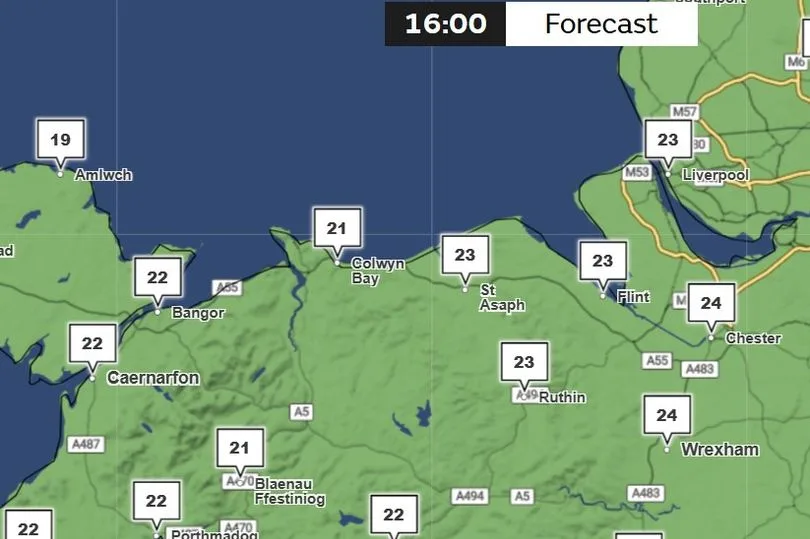
The Met Office indicates the current heatwave—the third to hit the region this summer— is predicted to be over next Thursday, (July 16) when temperatures in Wrexham are set to dip below the 25C threshold. Other areas of the region are set to see cooler temperatures, but still 20C plus. Forecasts are subject to change.
A heatwave is defined as three consecutive days where temperatures exceed a particular threshold in the UK, depending on where you are in the UK. For North Wales it is 25C.
The region is currently bracing for the peak of the heat, with temperatures expected to climb as high as 30C in northeast Wales by Thursday and Friday of this week.
While meteorologists note this spell is less intense than the record-breaking extreme heat witnessed in late June, high pressure has locked in a much longer period of hot, dry weather. The North Wales Live Whatsapp community for top stories and breaking news is live now – here’s how to sign up
However, the relentless sunshine will eventually give way to more comfortable conditions. The breakdown of the heatwave is expected to begin over the weekend as humidity rises, bringing an increased risk of scattered showers and isolated thunderstorms across Wales.
Temperatures are forecast to dip completely below the 25C heatwave threshold on Thursday next week (July 16 2026) -Credit:Met Office
By the start of next week, cooler Atlantic air will steadily push across the country. The transition will culminate next Thursday, bringing a welcome reprieve for residents as the mercury drops below 25C, although still hot in areas.
A Met Office long range forecast for the UK, covering Saturday July 11 to Monday July 20, said: ” Southern areas are likely to start this period hot, with heatwave conditions persisting.
“To the north, an Atlantic frontal zone will introduce somewhat cooler conditions, with the potential for scattered thunderstorms to develop just ahead of this. Into the following week, high pressure is likely to build to the north or northwest of the UK, though its exact orientation is rather more uncertain.
“This would bring a lot of dry weather for many areas, though perhaps an increased chance, relatively to previous days, of showers or thunderstorms in the south. Temperatures probably moderating a little, though remaining above average for many areas.”
Sign up for the North Wales Live newsletter sent twice daily to your inbox