
The Environment Agency (EA) issued a notice for the Upper River Ouse in the city last night (March 25) which has carried on into this morning.
The government agency said high river levels may lead to flooding.
Areas most affected are riverside footpaths, roads near rivers and low-lying land.
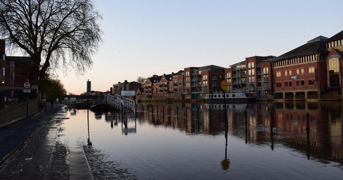
The agency said affected areas include King’s Staith, Queen’s Staith and South Esplanade in the city centre.
Met Office forecasts in York today are for sunshine with cloud cover coming in from mid-morning, with little chance of rain expected until this evening.

Temperatures will just stay above freezing this morning as gritters were seen on the Hull Road into the city but are not expected to reach ten degrees Celsius today.
A frosty start on Thursday with slippery surfaces and icy patches❄️
Windy in northeast Scotland with sleet and snow showers. Otherwise, a mostly dry and sunny morning with much lighter winds than on Wednesday🌤️
Showery rain arriving in Northern Ireland and western Scotland🌧️ pic.twitter.com/6tpyftaGA5
— Met Office (@metoffice) March 25, 2026
River Ouse levels in South Esplanade and King’s Staith were just lapping over the edge this morning although there was access to the steps for the Ouse Bridge on the eastern bank and vehicle access along Lower Friargate.
At the Viking Recorder in North Street Gardens the River Ouse level, measured at 6.45am, stood at 2.28 metres and falling, towards its normal range of 1.9 metres.
It is expected to reach level to that standard later today.
The EA says property flooding is possible above three metres and low-lying land flooding is possible above 2.20 metres.
A flood alert – meaning flooding is possible – is usually issued between two and 12 hours before flooding, the EA said.
Residents are urged to regularly check warnings for their area and follow official advice .
At the Foss Barrier close to the confluence of the two principal rivers in York, the level at 6.45am was 7.20 metres and falling, below the top of the normal range of 7.9 metres.
The highest level recorded here was 10.2 metres on November 4, 2000.
The agency’s advice in a flood alert – which means flooding is possible – is to avoid walking, cycling or driving through any flood water and highlights other at-risk areas such as fields, recreational land and car parks, minor roads, farmland and coastal areas affected by spray of waves overtopping.
All areas are being assessed by the Environment Agency later this morning, it said.