During the Great Game (the struggle between Britain and Russia for control over parts of Central Asia), British officers extensively mapped trade routes and corridors across Afghanistan, Central Asia and the Iranian Plateau. British author Peter Hopkirk’s works, such as The Great Game and Trespassers on the Roof of the World, describe the adventures of British officers and Indian “Pundits.” They used the Karakoram Pass, Hunza Valley and Chitral to enter Turkistan, Tibet and Central Asia. However, there is little evidence of any significant attention being paid to the Saltoro Ridge. This absence suggests that the area held little strategic relevance in the pre-Partition era. Consequently, the modern strategic history of the Saltoro Ridge effectively begins with the Partition of India in 1947.
The Partition Plan, signed on June 3, 1947, created far more conflict than it solved. In October 1947, barely two months after partition, Pakistan launched a brazen invasion of the princely state of Jammu and Kashmir (J&K). Pakistan used Pashtun tribesmen and soldiers disguised as tribesmen to invade J&K.
The conflict continued through the winter of 1947 and into 1948. Indian forces showed great tenacity, especially in Srinagar, Uri and Kargil, and made steady territorial gains during 1948. However, political developments of 1948 altered the geographical control, military requirements and strategic planning.
UN, ceasefire and the cartographic negligence
In early 1948, Prime Minister Jawaharlal Nehru, acting on the advice of British statesman and admiral Lord Louis Mountbatten, referred the Kashmir dispute to the UN. In his extraordinary book War and Diplomacy in Kashmir: 1947–48, Indian civil servant, diplomat and writer Chandrashekhar Dasgupta unearths a great deal of archival evidence. He suggests that the political misjudgments and presence of the British military officers resulted in India losing control over large parts of J&K.
The UN process led to a formal ceasefire that came into effect on December 31, 1948, with hostilities ceasing on January 1, 1949. Over the following months, several resolutions were debated in the UN. These efforts culminated in the signing of the Karachi Agreement on July 27, 1949.
The agreement attempted to demarcate a ceasefire line (CFL). The Shimla Agreement of 1972 renamed the CFL as the Line of Control (LoC). The CFL extended approximately 740 kilometers, starting from the Jammu division. It ran “up to point NJ9842, beyond which the terrain is heavily glaciated.” Point NJ9842 corresponds to the last mapped point of the CFL. It lies to the southwest of the Saltoro Ridge.
Over the years, several controversies have erupted over the legal right to the Saltoro Ridge. However, the Karachi Agreement was very clear on the Indian ownership. The agreement, in Paragraph B, sub-clause D of the declaration, states that from point NJ9842 the CFL goes “thence north to the glaciers.” This gave India legal control of the Saltoro Ridge.
Simultaneously, clause C of the agreement specified that the CFL would be drawn on a one-inch official map. It was also required to be verified by local military commanders of India and Pakistan. However, this verification process was never completed. As a result, the northern sector beyond NJ9842 remained undefined on official maps. This Indian negligence in not delineating the boundary created a strategic vacuum. This was later exploited by Pakistan, culminating in India’s Operation Meghdoot of 1984.
Operation Meghdoot
In the 1950s and 1960s, the issue of the Saltoro Ridge was rarely discussed. The bigger picture in that era was the western front with Pakistan and the northern and eastern front with China. India’s China policy ended in disaster, culminating in a humiliating defeat in the 1962 war. Pakistan, after seeing India humiliated in 1962, “gifted” Shaksgam Valley to China in 1963. Pakistan, at the time, also started to lay the groundwork for Operation Gibraltar, which it executed in 1965.
The issue of the Saltoro Ridge could have been solved peacefully by the Shimla Declaration. However, the declaration merely reiterated the position laid down in the Karachi Agreement. It did not provide for any on-ground verification. This failure to establish a clearly delineated boundary, even after the massive military victory in the 1971 war, was a diplomatic blunder for India.
This was exploited by Pakistan during the 1970s and 1980s. Pakistan began issuing permits to foreign mountaineers for expeditions in the Siachen Glacier, which forms part of the Saltoro Ridge. These activities alarmed Indian policymakers. Intelligence assessments coming from 1983 revealed that Pakistan was planning an offensive named “Operation Ababeel.” Operation Ababeel was planned to be launched from Skardu in the Baltistan Division.
Confronted with this threat, the Indira Gandhi government finally acted decisively. In 1984, India launched Operation Meghdoot, occupying the passes of the Saltoro Ridge and securing its dominant position. Today, the Indian troops control Sia La, Bilafond La and Gyong La — all three major passes of the Saltoro Ridge. The Pakistani troops, on the other hand, are at the bottom of the ridge. The planning of Operation Meghdoot was done by then General officer Commanding-in-Chief of the Northern Command, a saint-soldier, Lieutenant General Manohar Lal Chibber.
The geographical significance of the Saltoro Ridge
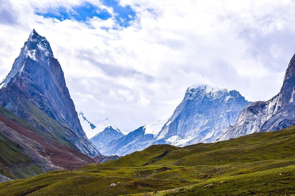
Geographically, the Saltoro Ridge occupies an extremely sensitive position in the northern frontier. To its north lies the Baltistan region of Pakistan-occupied Kashmir. To the northeast is the Chinese-occupied Shaksham Valley. To the West lies the Skardu air base in the Baltistan division, an important logistical and operational hub of the Pakistani military. The southern extremity of the ridge feeds the Nubra River system.
The strategic value of the Saltoro Ridge is further reinforced by the cushion it provides to critical Indian military installations. It lies to the North of the Daulat Beg Oldi (DBO) sector and the Y-junction area (where South Asia meets Central Asia). The DBO, along with hosting an advanced landing ground (ALG), lies just eight kilometers south of the Karakoram Pass (KK) and nine kilometers Northwest of Chinese-occupied Aksai Chin.
The ridge’s geographical advantage is further strengthened by its proximity to the KK, just a few miles east. To its south lies the adjoining Sub-Sector North (SSN), the frontline region of Indian military planning against adversaries. Control over the ridge line allows India to maintain maximum deterrence with minimum military presence in the frontier.
Thus, the greatest geographical significance lies in the fact that the Saltoro Ridge constitutes the only natural geographical barrier separating the on-ground Chinese and Pakistani military coordination. As long as India controls the ridge, the possibility of physical military coordination between the two is slim. This provides India with a decisive geographical advantage in any future contingency.
Second, Indian control over the ridge denies both adversaries access to dominating heights. Currently, even from the most forward Pakistani military positions, the Siachen Glacier is not visible, giving India a clear-cut advantage.
In mountain warfare, the possession of high ground, on most occasions, determines the outcome of a conflict. Pakistan has repeatedly sought to alter this balance. Some war veterans have argued that the Kargil Conflict of 1999 was ultimately aimed at dislodging India from the Saltoro Ridge.
The Indian negotiations
The Saltoro Ridge is an inhospitable region marked by extreme weather and logistical nightmares. Soldiers deployed in Siachen face grueling challenges. Drawing on the experience of his brother, this author is very well aware of the difficulties faced by soldiers. Many soldiers during their deployment develop lifelong medical complications. They require periodic medical attention. It takes a heavy toll on families.
Due to this, several Indian scholars and diplomats have argued for the withdrawal of Indian troops. A famous author in International Relations even wrote, “the strategic value of Siachen is at most ambiguous.” However, the most vocal among this school of thought is the former Foreign Secretary (FS) Shyam Saran. Saran headed the Ministry of External Affairs between 2004 and 2006. In his book, “How India Sees the World”, he wrote that as FS, he successfully negotiated the withdrawal of Indian troops from Siachen. However, then National Security Advisor (NSA) MK Narayanan “launched a bitter offensive against the proposal,” and the then Chief of Army Staff (COAS) General J.J. Singh backed the NSA. The NSA categorically said “Siachen shall be taken off the table,” effectively torpedoing the negotiations. The FS was aghast at this.
Negotiations under Musharraf: a hoax
Pakistan too has consistently sought the withdrawal of Indian troops from the ridge. Pakistani sides often say that it will be a great exercise in confidence-building. It will build trust and usher in an era of peaceful coexistence. Former Pakistani President General Pervez Musharraf initiated negotiations with former Indian Prime Minister Dr. Manmohan Singh to make Siachen a “peace mountain.”
Interestingly, as a Brigade Commander in 1987, Musharraf made a dash to capture the Bilafond La. India, in response, launched Operation Rajiv and outsmarted Musharraf. Musharraf failed to achieve military and political objectives. But, he gained firsthand experience of the terrain and the geographical advantage of controlling the ridge.
The negotiations under the aegis of the Atlantic Council continued even after the removal of Musharraf. However, ultimately, they failed to produce any substantive outcome. The negotiations, from an Indian perspective, reflected a pattern in which diplomacy took far more heft than military planning.
The major reason for failure was the extreme difference of opinion. While India negotiated with a view to helping its soldiers and building trust, the Pakistani side was negotiating to keep its Eastern front (Indian border) calm while it was involved with the US in Afghanistan.
Major Agha Amin, a military historian and Pakistan Army veteran, aptly captured Pakistan’s negotiation strategy in 2011. He wrote:
Utopians in India are jubilant that Pakistan has made peace with India. Nothing in reality can be farther from the truth. The Pakistani apparent shift is merely a tactical response to extreme confrontation with the US over perceived US view that Pakistan is playing a double game in Afghanistan. This is similar to Musharraf’s flirtation with India from 2000 to 2007, which in reality was a gambit to prevent a two-front war with Afghanistan occupied by the USA and a hostile India in the east. The real picture of true intentions of the Pakistani military will emerge when the US withdraws from Afghanistan.
More than a decade later, Major Amin stands vindicated.
Peace with India was never the desire of the Pakistani military. The negotiations on Saltoro Ridge were only meant to bring temporary relief to the constrained Pakistani military.
Why must India maintain a military presence on the Saltoro Ridge?
The first and most compelling reason as to why India must maintain control of the ridge is strategic irreversibility. If India were to withdraw and Pakistan were to subsequently occupy the ridge, any attempt to reclaim it would require a major military offensive. Such an operation would entail heavy casualties and enormous financial costs, with no guarantee of success. No doubt it will also be a political disaster.
Currently, only one Brigade is present on the Siachen Glacier. However, if India withdraws and then tries to capture it, it will require more than one Brigade. In addition to this, a large military build-up at SSN would be required with the mobilization of a mountain division, multiple armored regiments, artillery systems and special forces.
Thus, vacating a hard-won and strategically dominant position would therefore amount to voluntarily surrendering a vital advantage and creating the conditions for a future conflict under threatening circumstances.
Second, China’s expanding military infrastructure in Tibet and the Shaksgam Valley has further enhanced the ridge’s importance. Given the close strategic partnership between China and Pakistan, coordinated operations cannot be ruled out. Indian military assessments during last year’s Operation Sindoor have indicated that China shared satellite information of the movement of Indian troops with Pakistan. China, given the presence of numerous glaciers on the ridge, has its own designs. A withdrawal from the Saltoro Ridge would open physical and strategic space for China to exploit.
Finally, with the signing of the Instrument of Accession on October 26, 1947, the whole state of J&K became part of India. Thus, the Indian presence on the Saltoro Ridge is on Indian territory. Why should India negotiate the withdrawal of troops from its own territory? Does the Indian government ask Pakistan to remove corps from Bahawalpur, Lahore or Gilgit? Or does the government ask China to stop building military infrastructure in Tibet? Thus, maintaining presence on the Saltoro Ridge must remain contingent on Indian security requirements, not on confidence-building measures with China and Pakistan.
The enduring power of geography in national security
Throughout the long history of warfare, geography has continued to dictate national security. For India, the lessons of geography are even more important. India faces two hostile nuclear-armed neighbors and the vast Himalayan landmass along its northern and eastern frontiers.
The Saltoro Ridge represents one of the few geophysical configurations that strengthen the Indian position. It enables India to maintain the status quo in eastern Ladakh. It reduces long-term financial and military costs. In addition to this, it prevents the possibility of coordinated China–Pakistan military operations.
Any alteration to the existing arrangement would certainly trigger a military showdown on the world’s highest battlefield. Pakistan’s historical conduct and the psychology of its military establishment provide ample evidence of this risk. Under these circumstances, maintaining control of the Saltoro Ridge remains a strategic necessity for India’s long-term security.
[Kaitlyn Diana edited this piece.]
The views expressed in this article are the author’s own and do not necessarily reflect Fair Observer’s editorial policy.