





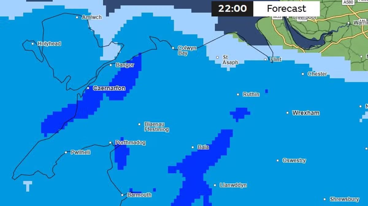
North Wales is bracing for significant disruption as the region prepares for a period of severe weather that could signal the arrival of the first named storm of the season. The Met Office has warned that heavy downpours and gale-force winds are set to sweep across the country, with coastal areas expected to bear the brunt of the impact.
Forecasters are tracking a deep area of low pressure currently moving across the Atlantic, which is expected to cross the UK between Thursday night and Friday. By 1pm on Friday, wind speeds in Holyhead on Anglesey are predicted to reach up to 61mph, while other parts of North Wales should prepare for gusts of at least 48mph.
In addition to the wind, persistent and heavy rain is expected to affect the entire region from 10pm on Thursday, continuing throughout Friday morning. The Met Office has already issued a 12-hour yellow weather alert for wind, which will be in effect from midnight on Thursday until midday on Friday, specifically covering large sections of south and mid-Wales.
Tom Crabtree, Deputy Chief Forecaster for the Met Office, highlighted the uncertainty currently surrounding the system. “An area of the forecast we’re particularly focusing on is the development of a potentially deep area of low pressure,” he said. “It has the potential to bring some strong winds, though the precise location of the strongest gusts will be determined by the final path of the low-pressure center. People should keep a close eye on the forecast and be prepared for unsettled weather at the end of the week.”
If the weather front meets the necessary criteria for severity, it will be officially named “Storm Austen” under the collaborative naming system used by the UK, Ireland, and the Netherlands.
While current computer models suggest the centre of the low-pressure system may track across the south of the UK—potentially sparing Scotland and Northern Ireland—forecasters warn that a more northerly shift in the track remains a possibility. Such a change would result in more widespread gales and disruption across the entirety of the UK.
The adverse conditions have prompted warnings from the Mountain Weather Information Service, which has advised hillwalkers and outdoor enthusiasts to prepare for rapidly deteriorating conditions. The service noted that while Thursday may offer a brief window of drier weather, the incoming system on Friday could bring heavy rain and gales, with the potential for snow on higher mountain peaks.
With the forecast remaining subject to change, authorities are urging the public to stay updated with the latest Met Office warnings and to remain vigilant as the week concludes. The current outlook suggests an unsettled spell of weather is likely to prevail across the region through the end of October.
Disclaimer: This content is auto-generated for informational purposes only.
Source: Read Original News