








PHOENIX – A rare and violent storm system tore across northern and central Arizona between Tuesday night and Wednesday morning, unleashing golf-ball-sized hail, damaging wind gusts, and triggering a level of severe weather alert not seen in the state for over a decade.
The National Weather Service (NWS) issued a flurry of emergency warnings as the storm front moved through the region. Residents reported hail measuring 2 to 3 inches in diameter, which shattered windows, pummeled roofs, and left a trail of dented vehicles across the impacted areas.
Perhaps most alarming for state meteorologists was the emergence of tornado risks. Authorities issued formal tornado watches for multiple locations, marking the first time such alerts have been posted in Arizona since October 2010.
Ryan Bernhart, a meteorologist with the National Weather Service in Flagstaff, explained that the atmospheric conditions were highly atypical for this time of year. The storm was fueled by a surge of warm, moist air migrating north from the California coast. As these systems interacted with shifting wind patterns, they created the rotation necessary to generate tornado threats.
“This is very unusual for this area at this time of the year,” Bernhart noted, emphasizing the rarity of the event.
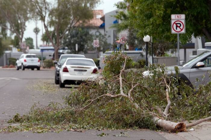
The physical toll of the storm was most visible in the structural damage and downed vegetation. Powerful winds toppled trees across the region, including in Flagstaff and Mesa, where some debris crashed onto walls and carports. In the Coconino National Forest, located northwest of Flagstaff, the storm’s ferocity was enough to uproot dozens of mature ponderosa pines, many measuring over 30 feet tall.
“These are not small trees that are down,” Bernhart said. “These are pretty strong trees that had been knocked down.”
While the immediate threat of high-velocity winds and large hail began to subside by Wednesday, authorities warn that the danger is far from over for the Phoenix metropolitan area. Mark O’Malley, a meteorologist at the NWS office in Phoenix, stated that the primary concern has shifted to the heavy rainfall accompanying the storm’s tail end. Officials are warning of potential flash flooding through Thursday morning, urging residents in low-lying areas to remain vigilant.
Emergency management teams have spent the morning assessing the damage, and utility companies are working to restore power to areas where wind-driven debris disrupted service. While cleanup efforts are underway, the National Weather Service continues to monitor the atmospheric conditions, advising citizens to keep a close eye on local weather alerts and to seek shelter immediately if new warnings are issued as the remainder of the storm system pushes through the state.
Copyright 2026 The Associated Press. All rights reserved. This material may not be published, broadcast, rewritten or redistributed without permission.
Disclaimer: This content is auto-generated for informational purposes only.
Source: Read Original News