








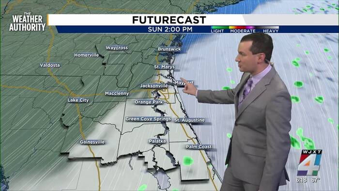
JACKSONVILLE, Fla. – A powerful cold front has stalled just south of the region, ushering in a dramatic shift in weather that promises breezy conditions and a cool-down for Northeast Florida. Residents should prepare for a windy weekend as gusty conditions take hold across the area.
For the remainder of the day, the region will experience partly to mostly cloudy skies with temperatures hovering near 70 degrees. However, the wind will be the primary story; forecasters warn that gusts could reach up to 40 mph, with the highest impact expected along the coast.
This shift has prompted officials to issue a Wind Advisory for coastal areas, which is set to remain in effect through 8 p.m. Sunday. The persistent, strong northeasterly winds are bringing a variety of coastal hazards, including the threat of tidal flooding, rough surf, and an elevated risk of rip currents. Beachgoers and mariners are urged to exercise extreme caution when near the water until the weather pattern stabilizes.
As the sun sets this evening, temperatures will drop into the 50s for areas west of Interstate 95, while the coast will see slightly milder, though still chilly, overnight lows in the 60s. Sunday is expected to follow a similar pattern, featuring a mix of sun and clouds alongside those sustained, gusty winds.
Looking ahead to next week, the influence of a high-pressure system positioned to the north will keep a northeasterly breeze in the forecast. While the wind will persist, it will also usher in lower humidity and plenty of sunshine for the upcoming work week, providing a pleasant, if brisk, start to the period.
Beyond the immediate weather, there is positive news regarding the region’s long-term environmental conditions. The latest drought monitor shows significant improvement across the area. Following a week of heavy rainfall, several regions have been completely removed from drought status, offering a welcome relief to local landscapes and water tables.
Looking at the week ahead:
- Tonight: Partly cloudy and windy with a low of 56 degrees.
- Sunday: Mostly cloudy and windy, with a high of 69 and a low of 57.
- Monday: Partly cloudy and windy, but remaining mostly dry. Highs near 71, lows around 57.
- Tuesday: Sunshine returns with breezy conditions. Highs climbing to 75, lows near 56.
- Wednesday: Mostly sunny with comfortable highs near 77 and lows of 58.
Residents are encouraged to keep an eye on local forecasts, as the wind, while cooling, may cause minor travel disruptions or power outages in vulnerable areas. Stay tuned to News4JAX for the latest updates on this developing weather pattern.
Disclaimer: This content is auto-generated for informational purposes only.
Source: Read Original News