
The warning covers all of Greater Manchester during the record-breaking heatwave

The Met Office has issued a thunderstorm warning(Image: Met Office)
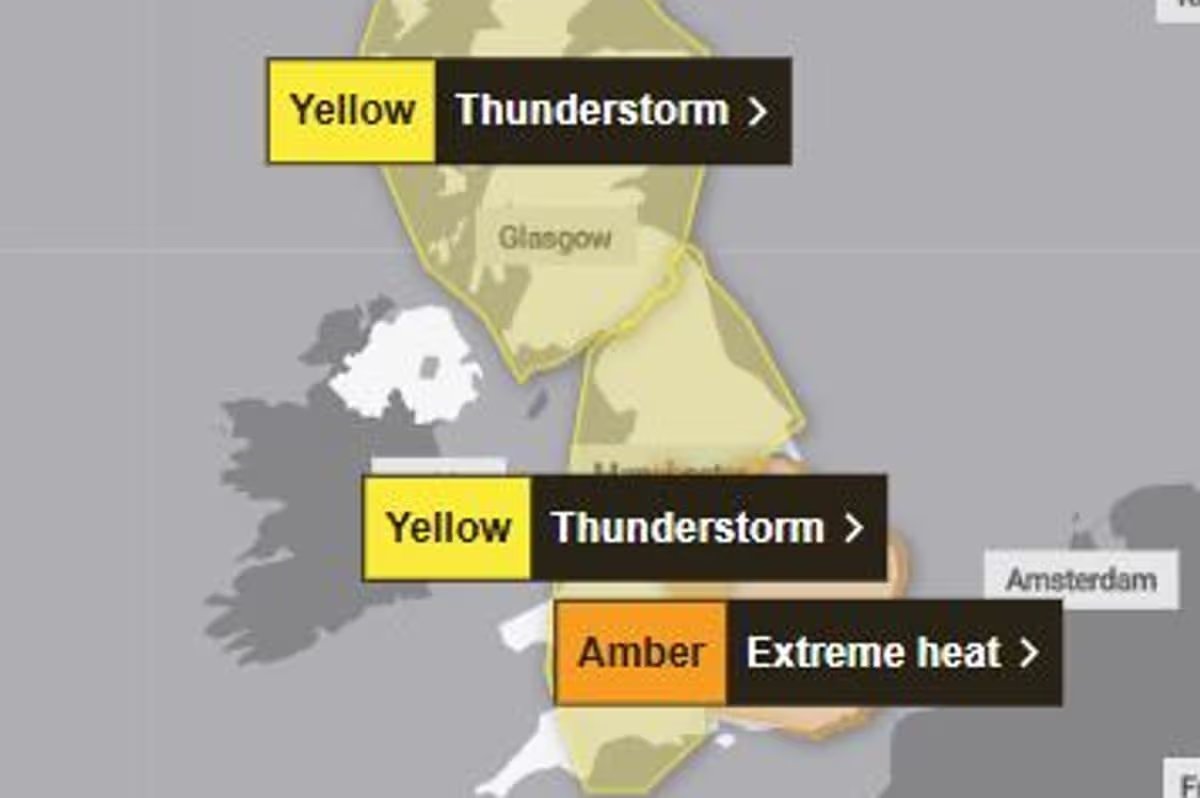
The Met Office has issued a new thunderstorm warning for Greater Manchester and much of England and Wales amid the record-breaking heatwave this week.
The 10-hour yellow warning for thunderstorms will come into force at 12am tomorrow (Friday) and last until 10am. The Met Office has warned of disruption amid thunder, lightning and heavy rain.
This comes amid an extreme heat weather warning as a ‘heat-dome’ over Europe brings extremely hot and humid conditions to much of the UK. On the thunderstorm warning, the forecaster said: “Many areas are missing the worst, but thunderstorms could bring disruption in places during Thursday night and into Friday morning.”
Click here to get the biggest stories straight to your inbox in our Daily Newsletter
Forecasters have warned of a ‘slight chance’ of power cuts and a ‘small chance’ of flooding to homes and businesses. Thunderstorms may lead to some travel disruption.
The warning covers all of Greater Manchester as well as the North West, East Midlands, parts of London and the South East of England, the North East of England, South West England, Wales, the West Midlands and parts of Yorkshire and the Humber.
A separate yellow weather warning for thunderstorm has been issued for much of Scotland by the Met Office. This comes into force at 12am on Friday and will last until 11.59pm.
Forecasters have warned that temperatures could rise even higher after records were broken yesterday. Provisional figures suggest the temperature reached 36.1C in Gosport, Hampshire, breaking the previous June record from the summer of 1976.
The heatwave forecast is set to continue today and on Friday, and the Met Office said it is possible the figure could be ‘beaten again’. Wednesday’s high breaks the previous top temperature for June of 35.6C in 1976 and 1957, the forecaster said.