









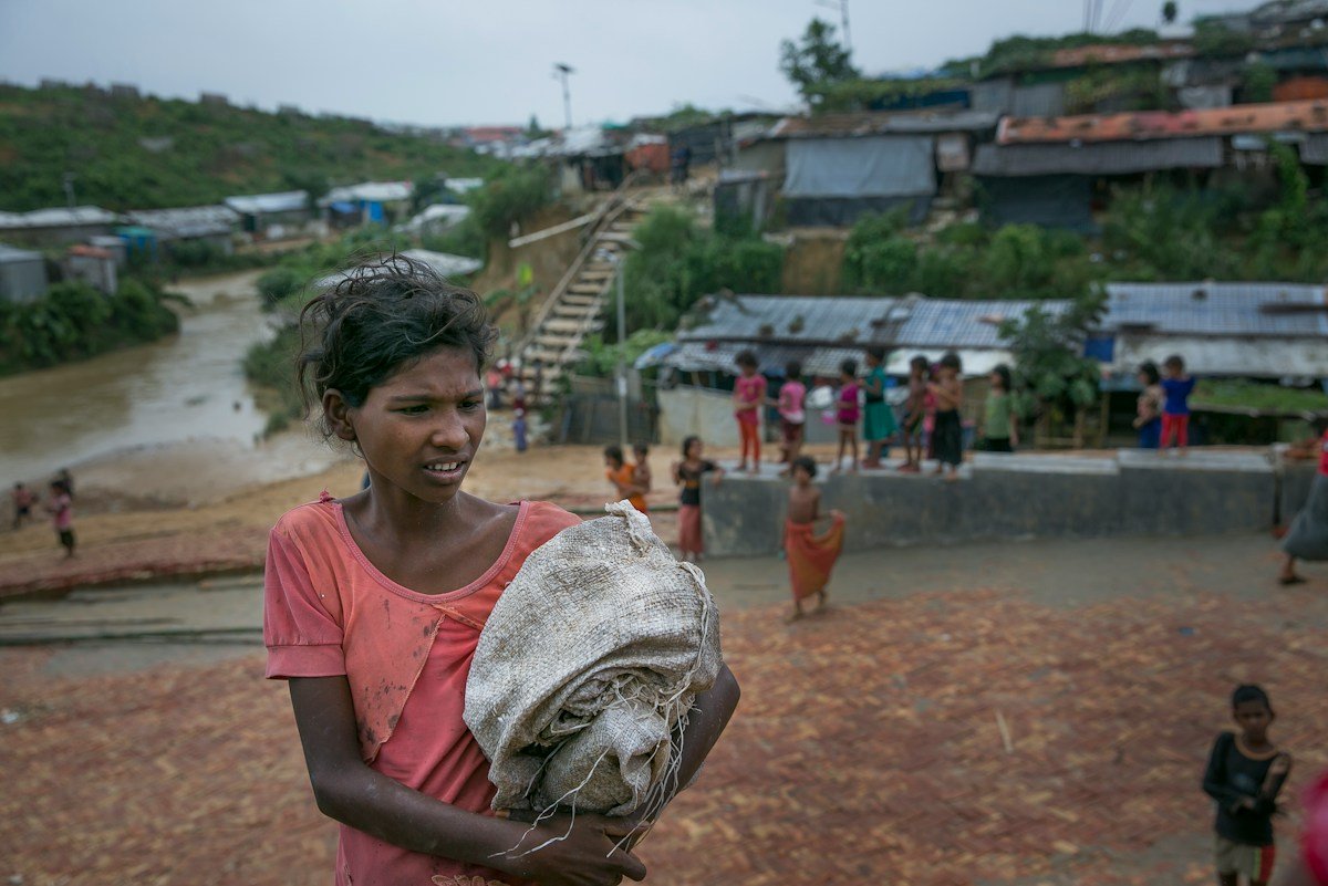
A new surge of arrivals at Bangladesh’s Rohingya refugee camps has triggered a dire humanitarian and environmental crisis, with government data revealing that over 150,000 people have fled Myanmar to enter the Teknaf and Ukhiya settlements in the last few months. This influx has pushed the population density of these 24-square-kilometer camps to staggering levels, leaving the region increasingly susceptible to catastrophic landslides.
## The Intersection of Crisis and Climate Data
The overcrowding is pushing refugees onto unstable, hilly terrain that was historically part of the region’s protected forest land. As the physical environment is altered to accommodate new shelters, researchers are turning to advanced geospatial analysis and AI-driven modeling to track the worsening risk. Studies indicate that since the initial 2017 influx, over 8,000 acres of reserved forest have been cleared, destroying the natural root systems that once held these sandy slopes together.
Experts from the University of Dhaka are utilizing modern mapping technologies to categorize slope vulnerability. Their latest findings are stark: the number of high-risk slope units—areas prone to collapse during the monsoon season—has tripled since 2021. Despite these data-driven warnings, the physical reality on the ground remains grim. Between early and mid-July of this year alone, over 200 landslides occurred, resulting in 15 deaths and the displacement of thousands more.
## Tech-Driven Disaster Mitigation and Funding Gaps
While researchers and relief organizations are leveraging data to identify the most critical zones for stabilization, the implementation of these solutions is hampered by a significant lack of funding. Emergency management agencies require tens of millions of dollars to install drainage systems, implement watershed management, and reinforce slopes. Currently, the Rohingya Refugee Response collective reports a budget shortfall of over $70 million for essential infrastructure and safety measures.
The tech industry, particularly through the use of Google Earth Engine and satellite imagery, has been pivotal in monitoring the rapid deforestation and landscape shifts occurring in Cox’s Bazar. By visualizing these changes, international agencies can advocate more effectively for donor support. However, technology cannot replace the need for physical materials and labor. Without the necessary capital, proposed engineering interventions remain trapped in the design phase, leaving thousands of refugees living in red-zone areas marked by authorities as “high-risk.”
## Human Resilience Amidst Structural Instability
The tragedy of the situation is compounded by the reluctance of many refugees to relocate. Despite authorities placing red warning flags on high-risk dwellings, some inhabitants refuse to move, citing fears that leaving their current spots could lead to permanent eviction or eventual forced repatriation to Myanmar.
This human element underscores a systemic challenge: disaster risk management in a refugee context is not merely a technical or engineering problem, but a complex social one. As long as the camps remain at maximum capacity, there is no “safe” space for relocation. Officials like Mohammed Mizanur Rahman, the refugee relief and repatriation commissioner, emphasize that the environment has reached its absolute carrying capacity. “Any expansion means destruction of new forests and hills, and Bangladesh cannot afford it anymore,” he noted.
As the monsoon season continues to threaten the region, the reliance on real-time monitoring and international aid remains the primary defense for over 1.1 million people living on the edge of a landscape that is quite literally collapsing beneath them. The urgent need for stable, long-term infrastructure funding continues to outpace the technological data provided by researchers, leaving a vulnerable population waiting for a solution that remains under-resourced.
Disclaimer: This content is auto-generated for informational purposes only.
Source: Read Original News