







Satellite Data Reveals Stark Shift: Pakistan’s Punjab Outpaces India in Crop Residue Burning
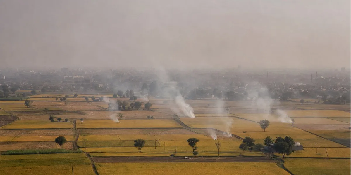
As the winter smog season intensifies across the Indo-Gangetic plains, new data has shed light on a significant reversal in agricultural fire trends. According to a recent analysis by the environmental platform HamariHawa, which utilizes NASA’s Fire Information for Resource Management System (FIRMS), Pakistan’s Punjab province has recorded significantly higher incidences of field burning compared to its Indian counterpart throughout October.
Between October 1 and October 29, satellite sensors—including those aboard the Suomi NPP, NOAA-20, and NOAA-21 platforms—detected 13,241 fire hotspots in Pakistan’s Punjab. In contrast, India’s Punjab recorded 3,158 hotspots during the same period. This indicates that fire activity in the Pakistani province was 4.2 times higher than in the Indian state, marking a dramatic shift in historical environmental data.
A Reversal of Trends
The findings highlight a striking contrast when compared to figures from half a decade ago. In 2019, the situation was largely inverted, with India’s Punjab reporting 14,002 hotspots against 2,908 in Pakistan’s Punjab.
However, recent analysis shows a consistent downward trajectory for India. Historical assessments indicate that satellite-detected agricultural fires in India’s Punjab have plummeted by approximately 95% between 2021 and 2025. Conversely, the trend in Pakistan’s Punjab has moved in the opposite direction, with a 33% increase in recorded fires between 2019 and 2025.
The report notes that 92% of the hotspots identified in Pakistan were situated on agricultural land, pointing to the widespread practice of burning crop residue as the primary driver behind the surge. The intensity of this activity peaked toward the end of October, with nearly half of the month’s total fires—6,655 incidents—occurring in the final seven days. October 29 alone saw a single-day spike of 1,327 hotspots.
Geographic Hotspots and Public Health
The analysis further pinpointed specific regions contributing to the smoke load. The Okara district emerged as a significant source of fire activity, recording 2,144 hotspots, followed by Gujranwala and Nankana Sahib. Combined, these three districts alone generated more fire detections than the entirety of the Indian Punjab during the October window.
The impact of these fires is being felt acutely in urban centers. Experts from HamariHawa suggest that smoke generated in the districts surrounding Lahore is a major contributor to the city’s deteriorating air quality, which fluctuates significantly depending on wind patterns. By October 31, the air quality index (AQI) in Lahore had reached 232, categorizing it as “very unhealthy.”
In response to the mounting crisis, provincial authorities in Pakistan have mobilized 67 rapid-response teams tasked with monitoring fields and curbing the burning of crop residue. While these satellite detections provide a clear snapshot of fire activity, experts caution that they represent a conservative estimate. Clouds, dense smog, and the timing of satellite overpasses mean that many smaller fires likely remain undetected, suggesting the true scale of agricultural burning may be even higher than currently reported.
Disclaimer: This content is auto-generated for informational purposes only.
Source: Read Original News