







Coastal communities warned of high winds, flooding and dangerous surf
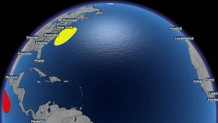
Residents along the United States East Coast are being urged to prepare for adverse weather conditions as meteorologists track a developing low-pressure system off the Atlantic seaboard. While the system is currently characterized as non-tropical, authorities are warning that its presence will pose significant hazards to coastal areas throughout the coming week.
According to the latest meteorological data, the low-pressure area is expected to form within the next 48 hours. Forecasters note that the system is projected to move slowly and erratically, lingering near the coastline through the middle of next week.
While the National Hurricane Center currently assigns a low probability of tropical or subtropical development—placing the formation chance at near 0% within the next two days and only 20% over the next week—experts stress that the classification of the storm is secondary to the threats it poses to the shoreline.
“Regardless of whether this system undergoes formal subtropical development, it will have a direct impact on our coast,” said meteorologist Chris Holtzman.
The primary concerns for coastal communities include a combination of high winds, persistent coastal flooding, and dangerous surf conditions. The slow, erratic movement of the system means that these conditions could persist over an extended period, leading to cumulative impacts such as beach erosion and the inundation of low-lying roadways and properties during high tide cycles.
Emergency management officials are advising residents in vulnerable areas to keep a close watch on local weather reports and to prepare for potential power outages and travel disruptions. Marine interests, including recreational boaters and commercial fishermen, are being warned of hazardous sea conditions that may make navigating coastal waters treacherous.
As of now, the system remains in its early stages of development, and the exact path of the low-pressure center remains difficult to predict due to its expected erratic movement. Meteorologists are continuing to monitor the situation closely to determine if the system will gain more defined atmospheric characteristics or remain a standard, albeit powerful, non-tropical low.
For those living in low-lying coastal zones, the time to ensure drainage systems are clear and emergency supplies are updated is now. Residents are encouraged to monitor updates from local news outlets and the National Weather Service as the system nears the coast.
This is a developing weather story. Further updates will be provided as the system evolves and more precise modeling becomes available regarding its projected track and potential for strengthening.
Copyright 2026 by WJXT News4JAX – All rights reserved.
Disclaimer: This content is auto-generated for informational purposes only.
Source: Read Original News