








Chaos in Birmingham: Residents Left to Battle Flash Floods as Storms Bring Dramatic End to Drought
The UK’s long-standing drought conditions have been brought to a sudden, dramatic end as a series of violent thunderstorms swept across the nation, leaving a trail of “significant flooding” in their wake.
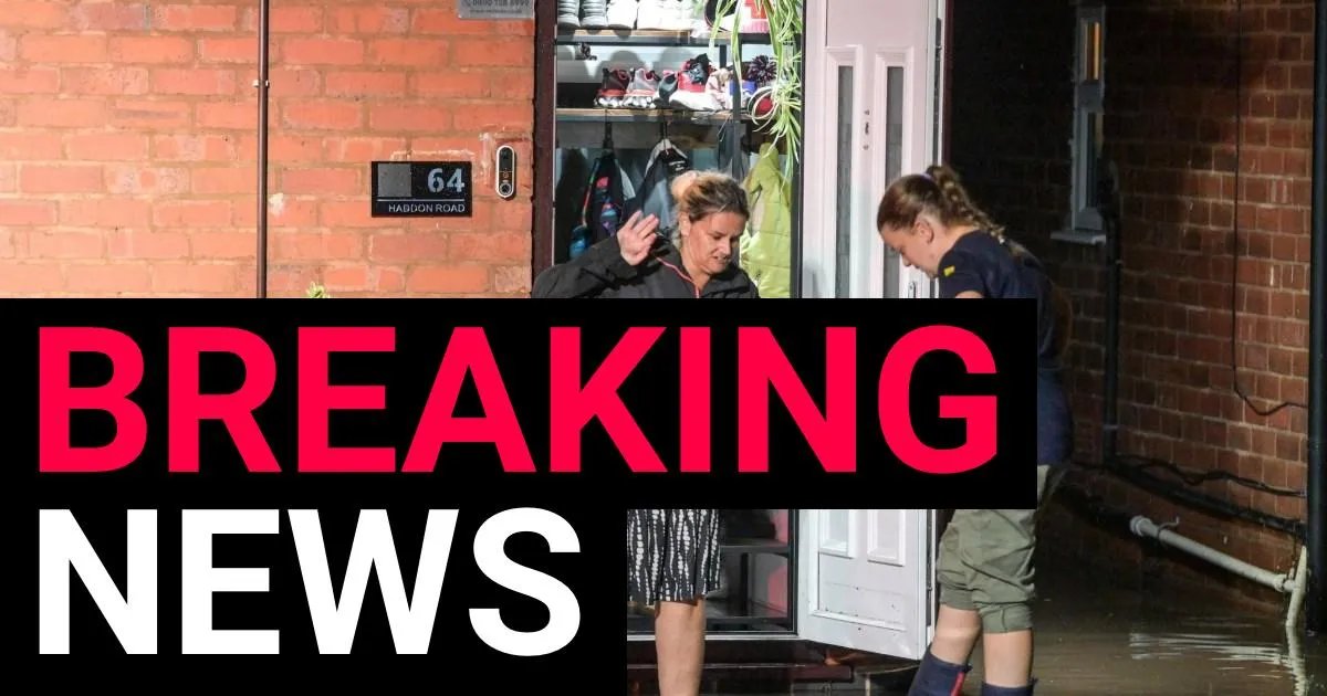
In Birmingham, the situation reached a critical point on Wednesday night when the River Tame burst its banks, transforming streets into rivers within an hour. The flash flooding on Church Road saw multiple vehicles submerged, with residents forced to take matters into their own hands as they bailed water out of their properties.
In one harrowing incident, an elderly driver was forced to escape his silver vehicle through the sunroof as the rising water levels threatened to trap him inside. Eyewitness reports from the scene highlighted the frustration of locals, who claimed that both the emergency services and the local council failed to intervene during the height of the crisis. Instead, two residents and a local traffic worker were seen working waist-deep in the deluge to manually unblock clogged drains in a desperate bid to protect their homes.
Warnings Across the Country
West Midlands Fire Service confirmed it attended several high-priority incidents around Curbar Road, Thornbridge Avenue, and Haddon Road. While the immediate threat in Birmingham is being assessed, the wider danger remains. The Environment Agency has issued 22 flood alerts—signaling that flooding is possible—across the Midlands and the South East.
The Met Office has issued two yellow thunderstorm warnings for Thursday. The first, affecting London and the South East, remained in place until 8:00 a.m. The second, a broader warning spanning Wales and much of England, is active from 5:00 a.m. until 10:00 p.m.
Forecasters warn that some areas could be battered by 50–75mm of rainfall within a 12-hour window. Accompanied by lightning, hail up to 2cm in diameter, and gusty winds, the weather is expected to cause significant travel disruption.
A Turn in the Weather
The sudden deluge marks a sharp contrast to the extreme heatwaves and water shortages that have defined the summer. With large parts of England and Wales having previously declared drought status, the ground is struggling to absorb the sudden influx of water, increasing the risk of surface flooding.
“We’re watching the risk of some heavy rain and thunderstorms moving up from the south,” said Met Office forecaster Craig Snell. “On Thursday… for parts of the Midlands and Wales, it’s going to be quite a wet day.”
While temperatures will remain relatively warm—peaking at 27 or 28C on Thursday—the Met Office expects a more seasonal cooling trend over the weekend, with highs dropping to between 22 and 25C. However, the wet weather is unlikely to dissipate immediately. Further heavy rain and thunderstorms are expected on Friday, and while the Bank Holiday weekend will not be a “total washout,” officials are advising anyone with outdoor plans to stay vigilant.
Birmingham City Council continues to urge residents and motorists to exercise extreme caution, advising that anyone should “take care and avoid walking, cycling or driving through flood water.” As the UK city hit significant flooding, local communities remain on high alert, bracing for further potential disruption in the coming days.