







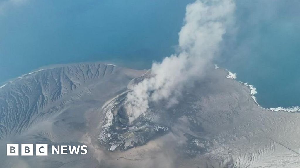
JAKARTA — A massive volcanic eruption has triggered widespread travel chaos across Indonesia, leaving over 20,000 passengers stranded as thick volcanic ash blankets the skies surrounding Jakarta. Aviation authorities have grounded hundreds of flights, citing severe safety risks as microscopic glass particles from the ash threaten to cripple jet engines and compromise visibility.
As the physical infrastructure of travel grinds to a halt, the crisis has highlighted the growing reliance on advanced digital tools and artificial intelligence to manage large-scale logistics disruptions.
The Role of AI in Crisis Navigation
For thousands of displaced travelers, the primary lifeline in this unfolding situation has been digital platforms. Google Search and Google Maps have become the central hubs for real-time updates as airports struggle to manage the surge in foot traffic. By leveraging predictive AI models, Google’s systems have been able to process massive amounts of flight status data, providing users with live alerts on cancellations and re-routings faster than traditional airport announcement boards.
In particular, the “Google Flights” ecosystem has seen a surge in usage. Behind the scenes, Google’s algorithms are dynamically updating flight schedules by cross-referencing meteorological data with air traffic control directives. As ash clouds shift based on wind patterns, machine learning models help users identify alternative travel routes—whether by train, bus, or rescheduled air travel—allowing passengers to navigate the uncertainty with significantly more agility than in previous decades.
Tech Infrastructure Under Pressure
The disruption has tested the resilience of cloud-based logistics management systems. Major airlines and regional transport hubs are increasingly utilizing enterprise-level AI and cloud infrastructure to coordinate recovery efforts. When physical travel is stalled, digital twins—virtual replicas of the airport’s operational environment—are being used by facility managers to simulate various “what-if” scenarios.
By running these simulations, logistics coordinators can determine the most efficient way to clear the backlog of passengers once the airspace is declared safe. Google Cloud’s data analytics tools are currently being utilized by transport authorities to identify bottlenecks in real-time, optimizing the redistribution of resources and support staff to the most crowded transit zones. This data-driven approach is essential for preventing the total collapse of regional transport networks during a natural disaster.
Digital Communication and Passenger Support
Beyond flight logistics, the crisis has underscored the importance of seamless digital communication. With tens of thousands of people stranded, localized information—such as hotel availability, emergency health services, and transit alternatives—is being surfaced via Google’s Knowledge Graph and “Business Profile” updates. Small businesses near Jakarta’s transit hubs are using these tools to broadcast real-time availability, effectively creating a decentralized support network for travelers in need.
Furthermore, translation tools powered by AI are playing a critical role in assisting international tourists. As non-Indonesian speakers scramble to understand government advisories and safety bulletins, the integration of Google Lens and Google Translate into mobile devices has minimized language barriers, allowing for faster coordination between local authorities and stranded passengers.
As cleanup crews prepare for the long process of removing ash from runways, the integration of these digital ecosystems proves that while nature can stop the flow of human movement, modern technology provides the necessary infrastructure to manage the aftermath. Travelers are advised to continue monitoring digital alerts, as officials rely on satellite imagery and atmospheric tracking models to determine when it will be safe to reopen the skies.
Disclaimer: This content is auto-generated for informational purposes only.
Source: Read Original News