









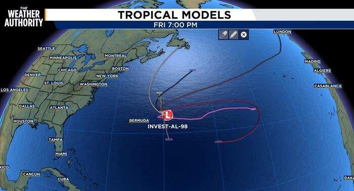
Invest 98 shows signs of weakening as it drifts through the Atlantic
The area of low pressure currently being tracked in the central Subtropical Atlantic, designated as Invest 98, appears to be struggling to maintain its structure. According to the latest reports, the system has become increasingly “lopsided and sloppy” as it continues its slow drift to the west-southwest.
Located a few hundred miles east of Bermuda, the disturbance is currently generating scattered showers and thunderstorms. However, meteorologists have noted that the system has lost significant organization over the past several hours. The environmental conditions surrounding the system remain turbulent, hindering any immediate potential for intensification as it continues to navigate the Atlantic.
The current movement is influenced by a complex regional pressure pattern. A notable pressure gradient exists between a high-pressure system sitting over the southeastern United States and a stationary front located near Bermuda. This interaction is sustaining moderate to fresh northeast winds and moderate sea conditions to the west of the front, creating a challenging environment for the developing disturbance.
Looking ahead, meteorologists expect high pressure to become the dominant meteorological feature across the basin throughout the upcoming weekend. Meanwhile, a broad upper-level low located east of Florida is projected to move toward the state over the next few days. This secondary feature is expected to sustain scattered to numerous showers and thunderstorms across most forecast waters, maintaining unsettled conditions as the weekend approaches.
Despite the ongoing activity, the official outlook for the system remains unchanged. Forecasters are currently giving Invest 98 a 20 percent chance of development over the next 48 hours. Looking further ahead to a seven-day window, the formation probability stands at 30 percent.
The Weather Authority continues to monitor the system closely as it traverses the Atlantic. Residents and mariners in the affected areas are advised to stay tuned to local forecasts for any potential changes in the status of the disturbance as it inches closer to the Florida coast.
For now, the system remains a disorganized collection of showers, and while it will contribute to general moisture levels across the region, there is no immediate indication that it will strengthen into a more significant weather event. Updates will be provided as the system moves or if its organizational status shifts.
Disclaimer: This content is auto-generated for informational purposes only.
Source: Read Original News