







Residents across the stateline are waking up to an unusually mild morning, with temperatures running 5 to 10 degrees higher than average. This pleasant start to the weekend is being fueled by strong southerly winds pumping warm air into the region, setting the stage for a warm and breezy Saturday.
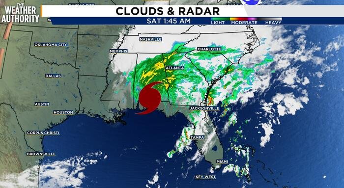
While the morning began with mainly clear skies, weather officials note that conditions will become increasingly blustery as the day progresses. The remnants of Hurricane Isaias, currently tracking north through Kentucky and Tennessee, are expected to influence local winds, pushing gusts to between 20 and 25 mph. Despite the influence of the storm system, the region is not expected to see any precipitation; however, cloud cover will gradually increase throughout the afternoon. Even with the added clouds, high temperatures are projected to reach the lower 80s.
As the sun sets, conditions are expected to remain comfortable, with temperatures dipping into the low-to-mid 50s. Skies will gradually clear overnight, providing ideal conditions for those looking to keep their windows open for a cool, fresh evening.
Sunday promises to be a standout day for outdoor activities. Forecasters predict ample sunshine with temperatures climbing back into the mid-to-upper 70s. With wind speeds dropping significantly to a manageable 5 to 10 mph, it will be an excellent day for yard work, dog walking, or firing up the grill for Sunday afternoon football games.
Looking ahead, the weather is set to take a significant turn. An upper-level ridge is expected to strengthen, bringing a blast of summer-like heat for Columbus Day and Indigenous People’s Day on Monday. Highs are projected to reach the mid-80s, placing the region more than 20 degrees above normal. This heatwave puts the area within reach of the record high of 85 degrees, set in 2008. While meteorologists suggest there is a strong possibility of hitting that record, current estimates place the high just shy of that mark.
The tranquility will be short-lived, however, as a major pattern shift arrives by the middle of next week. The region is bracing for an active period featuring daily chances for showers and thunderstorms as a series of cold and warm fronts sweep across the Midwest.
The transition will be accompanied by a dramatic drop in temperatures. After the mid-80s on Monday, the mercury is expected to fall into the 70s on Tuesday, reaching the 60s by midweek, and dipping into the 50s by next weekend. Residents should prepare for a “roller coaster” of weather, with forecasts suggesting that everything from t-shirts to heavy sweaters will be necessary within the span of just five days.
Disclaimer: This content is auto-generated for informational purposes only.
Source: Read Original News