










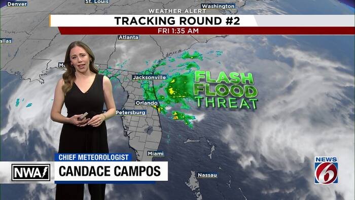
ORLANDO, Fla. – Central Florida is bracing for a dangerous escalation in weather conditions today as a persistent low-pressure system delivers another round of torrential rainfall to already saturated communities. A flash flood warning remains in effect for parts of Brevard, Seminole, and Volusia counties until 12:30 p.m., but forecasters warn that the threat will linger well into the evening.
The Weather Prediction Center has escalated its alert for the Space Coast and Volusia County to a “High Risk” (Level 4 out of 4) for excessive rainfall. This signifies the highest possible threat level, as heavy rain bands continue to move onshore, specifically targeting areas that are already struggling with significant water accumulation.
According to the News 6 Weather Team, residents should prepare for another 2 to 4 inches of rain across the region through Saturday. However, coastal communities in Brevard and Volusia counties face an even grimmer outlook, with estimates suggesting an additional 4 to 8 inches of rainfall, with localized pockets potentially seeing even higher totals. Because the ground is already fully saturated, meteorologists warn that any incoming rain will have nowhere to go, drastically increasing the likelihood of rapid, life-threatening flash flooding.
Compounding the crisis is the St. Johns River, which continues to rise to historic levels. The river near Cocoa recently crested at 18.48 feet, officially shattering the previous record set in 1953. Officials warn that as runoff from today’s storms makes its way into the river basin, levels are expected to climb even further into next week. While rain chances are slated to decrease by the weekend, the risk of river flooding is expected to persist throughout the month of December.
The hazardous weather is not limited to precipitation. A Wind Advisory is currently in effect for coastal Volusia and northern Brevard through 7 a.m. Saturday. Residents in these areas should prepare for sustained winds of 15 to 25 mph, with powerful gusts reaching 35 to 40 mph, which could exacerbate damage to structures already weakened by flooding and saturated soil.
Relief may be on the horizon, though the path to recovery will be slow. Forecasters anticipate rain chances will drop to 20% to 50% by Saturday as the low-pressure system tracks northward. Drier conditions are expected to finally arrive Sunday and Monday, offering a brief window of respite before a potential return of isolated showers by mid-week.
In the meantime, local authorities are urging residents to avoid flooded roadways, reiterating that “turn around, don’t drown” is more than a slogan—it is a critical safety instruction during this high-risk weather event. A Flood Watch remains active for the entire region through this evening.
Disclaimer: This content is auto-generated for informational purposes only.
Source: Read Original News