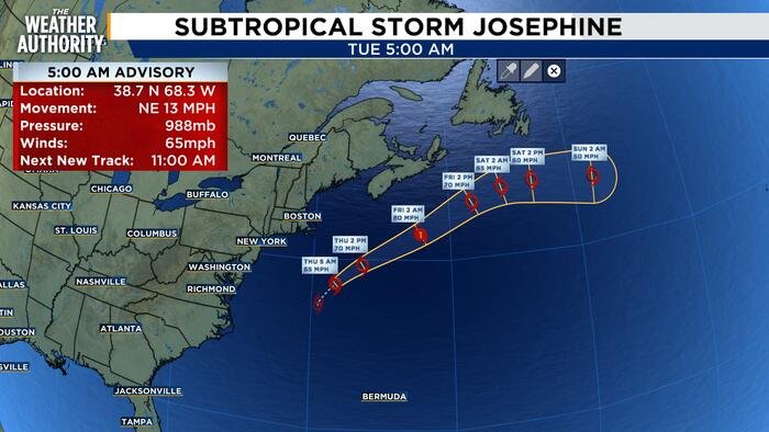









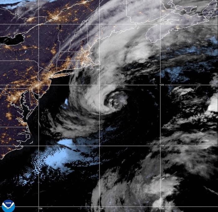
MIAMI – Subtropical Storm Josephine is pushing north from the U.S. Northeast coast early Thursday, sending a surge of coastal flooding and gusty conditions across the Eastern Seaboard. As the storm tracks away from the mainland, weather officials are warning of hazardous conditions for both maritime interests and coastal communities.
According to the National Hurricane Center (NHC) in Miami, Josephine was located approximately 265 miles south of Nantucket, Massachusetts, and roughly 585 miles southwest of Halifax, Nova Scotia, as of early Thursday. The storm is packing maximum sustained winds of 65 mph (100 kph). Forecasters expect the system to continue its trajectory away from the United States, remaining well south of Nova Scotia and Newfoundland as it moves into the open waters of the Atlantic.
Despite the storm’s path away from land, the National Weather Service has issued a gale warning covering parts of the Northeast and the mid-Atlantic. Authorities warn that wind speeds exceeding 39 mph (63 kph) are possible through midmorning Friday. Furthermore, small watercraft operators are being advised of dangerous conditions extending as far south as North Carolina’s Outer Banks. Coastal residents are also cautioned that minor to moderate flooding is expected to persist throughout the week along the mid-Atlantic coastline.
While meteorologists monitor the dissipating threats from Josephine in the Atlantic, focus is simultaneously shifting to the Pacific, where Tropical Storm Vance is gaining strength. Currently situated about 505 miles south of Acapulco, Mexico, the storm is showing signs of rapid development.
As of late Wednesday, Vance was recording maximum sustained winds of 45 mph (75 kph). However, models from the U.S. center indicate a significant escalation is imminent. Meteorologists expect the storm to intensify into a hurricane by Thursday, with further strengthening projected to turn the system into a major hurricane by Saturday. While the storm remains far off Mexico’s southwestern coast, its potential for rapid intensification is being closely observed by regional weather authorities.
The active tropical activity highlights a busy period for meteorologists across both oceans. While Josephine is expected to pose a diminishing threat as it heads into the northern Atlantic, the situation with Vance remains fluid. Residents in coastal areas under watch are urged to remain updated with the latest bulletins from the National Weather Service and the National Hurricane Center as conditions evolve.
For mariners, the combination of high winds and choppy seas remains the primary concern, and authorities are urging all small vessels to remain in port until the gale conditions subside. Local emergency management agencies along the U.S. Eastern Seaboard will continue to monitor the minor flooding events and provide updates as needed.
Copyright 2026 The Associated Press. All rights reserved.
Disclaimer: This content is auto-generated for informational purposes only.
Source: Read Original News