


SOUTHEAST GEORGIA — Residents across southeast Georgia are being urged to prepare for a prolonged period of hazardous weather as a soaking, windy, and potentially flooding event settles into the region for the remainder of the week.
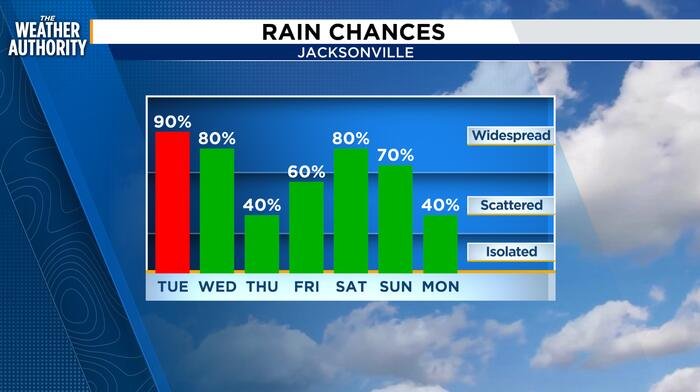
Following a weekend drenched by rounds of rainfall, the pattern shows no signs of breaking. Scattered showers and thunderstorms are expected to linger through this evening, with isolated storm activity forecast to continue overnight. However, conditions are expected to deteriorate further by Tuesday as a strong northeasterly wind increases to 15–20 mph.
Forecasters warn that the combination of relentless rain and increasing onshore winds will create a significant risk for flooding. Rainfall totals over the next five days are projected to range between 2.0 and 5.0 inches, with some areas likely to see even higher amounts depending on where storm cells “train,” or repeatedly move over the same locations. Counties along the coast, including Clay and Putnam, are currently highlighted as areas of concern for heavy, localized rainfall.
The threat extends well beyond the interior, as the combination of a nor’easter and high astronomical tides poses a serious risk for coastal flooding. Officials are warning of minor to moderate coastal flooding along the Atlantic coastline starting Tuesday evening and continuing through at least Thursday. Residents living along the Intracoastal Waterway and area rivers should also remain vigilant, as flooding is expected to become a concern within the St. Johns River basin from Wednesday morning through the weekend.
Beyond the water, beachgoers are cautioned to stay out of the surf. The adverse weather is expected to produce hazardous rip currents, rough surf, and significant beach erosion throughout the week.
The short-term forecast indicates an 80-100% chance of rain and thunderstorms on Tuesday, with temperatures ranging from the 60s at night to the low 80s during the day. While a slight lull in the heaviest rain may occur on Thursday, the unsettled, cloudy, and wet conditions are expected to persist through Friday. Current models suggest the unstable weather pattern will hold through the weekend, with winds not expected to shift southerly until Sunday.
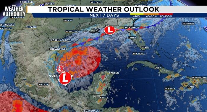
In addition to the immediate regional weather, meteorologists are keeping a close eye on the tropics, specifically a developing disturbance in the western Gulf of Mexico that could see potential development later this week.
Emergency officials advise residents to monitor local updates closely, as the heavy rain may trigger formal Flood Advisories. Those in flood-prone areas are encouraged to secure property and ensure they have a plan in place to navigate potential road closures and elevated water levels as this multi-day event unfolds.
Disclaimer: This content is auto-generated for informational purposes only.
Source: Read Original News