







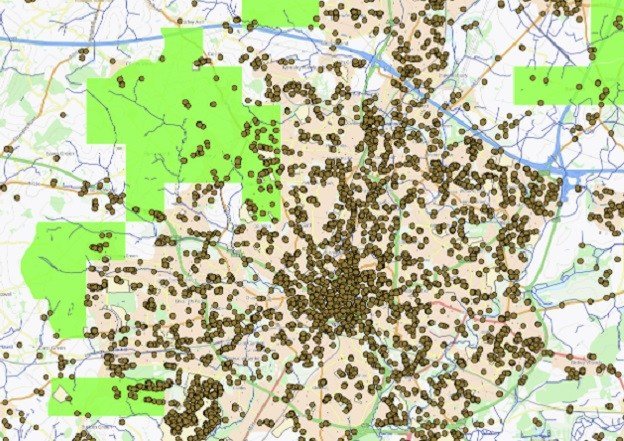
A sophisticated new mapping platform is transforming the way the UK Environment Agency (EA) manages flood risks and environmental improvement projects. By integrating high-precision location data from the Ordnance Survey (OS), the Stakeholder and Beneficiary Mapping Tool (SBMT) has moved disaster risk management from time-intensive manual analysis into a streamlined, automated digital environment.
Available to all EA staff and organizations participating in the UK’s Public Sector Geospatial Agreement (PSGA), the tool acts as a centralized hub for critical spatial data. It allows users to visualize, in real-time, who stands to benefit from flood defense projects, which partners are positioned to support delivery, and exactly who owns land affected by potential interventions.
The shift toward this data-driven approach is yielding significant operational efficiencies. In its inaugural year, the SBMT saved the Environment Agency more than 400 hours of labor and generated approximately £130,000 in financial savings by reducing the need for costly external consultancy and manual reporting. With more than 300 staff members now utilizing the platform, the tool has become essential for project planning, securing partnership funding, and ensuring joined-up environmental management.
At the core of the SBMT’s success is the Ordnance Survey’s National Geographic Database. By utilizing OS Buildings, water network data, and topographic products, the tool provides a “single source of truth” regarding land boundaries, property assets, and physical geography. When this data is cross-referenced with socio-demographic information, land ownership records, and flood risk projections, users are able to make rapid, high-impact decisions that were previously hindered by fragmented data silos.
The impact of the tool is already being felt across various sectors. For instance, the EA’s National Partnership Funding Team utilized the SBMT to conduct a comprehensive flood risk analysis for Tesco. The assessment of the supermarket giant’s 200 priority store locations—a task that would have historically taken weeks—was completed in mere minutes, saving roughly 40 hours of analyst time.
Similarly, Area Flood Risk Specialists have reported significant successes, with one assessment identifying 250 non-residential properties that stood to benefit from proposed flood protection measures. By utilizing the mapping tool, these teams avoided an estimated £28,000 in consultant costs. Furthermore, internal asset management teams have transitioned from manual searches to using the SBMT to identify landowners responsible for defective water infrastructure, resulting in an estimated 140 hours of saved time annually across 14 separate teams.
Tina Kennedy, Chief Customer Officer at Ordnance Survey, emphasized the necessity of accurate, trusted data in climate resilience efforts. “When organizations can see a complete and trusted picture of the places they serve, they can make better decisions and deliver greater impact,” Kennedy said. “By providing the authoritative location data that underpins the SBMT, Ordnance Survey is helping the Environment Agency and its partners identify opportunities faster, target investment more effectively, and work together to better protect communities from flooding while delivering wider environmental benefits.”
As the UK continues to face the growing challenges of climate-induced flooding, tools like the SBMT represent a critical evolution in infrastructure management. By digitizing the intersection of geography, property law, and risk analysis, the Environment Agency is not only saving taxpayer money but is also ensuring that flood protection resources are deployed where they are needed most, creating a more resilient landscape for the future.
Disclaimer: This content is auto-generated for informational purposes only.
Source: Read Original News