








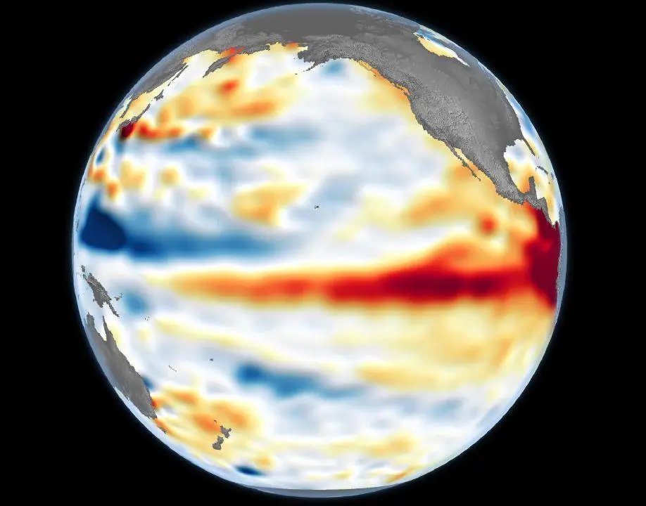
The Pacific Ocean is officially entering uncharted territory as an emerging El Niño event surges past historical benchmarks, signaling the potential for a record-breaking winter climate shift. According to the National Weather Service, sea-surface temperatures across a 2.4-million-square-mile stretch of the equator reached 2.5 degrees Celsius above average as of Monday, October 26, 2026.
If these elevated temperatures persist, this current El Niño will surpass the 2.3-degree anomaly record set between November 2015 and January 2016, marking the most intense event since formal record-keeping began in 1950. The scale of the warming has prompted urgent scrutiny from the scientific community, with all 27 models analyzed by Columbia University’s climate research institute predicting a “very strong” El Niño status. Some models suggest temperatures could spike as high as 3.5 degrees above the norm.
“We’re in good shape to at least challenge the record, if not break it,” said Oregon State Climatologist Larry O’Neill. “Right now, we’re in kind of uncharted territory.”
The impacts of such a potent El Niño are complex and vary by region. For the Pacific Northwest—specifically Washington, Oregon, and Idaho—meteorologists had initially labeled the winter outlook as a “tossup” regarding precipitation levels. This uncertainty caused concern among agricultural officials, as persistent warmth coupled with low rainfall could lead to significant water shortages during the 2027 irrigation season.
However, recent data has shifted the narrative. The Climate Prediction Center now expects a wetter-than-average November across the entire West Coast, including California. O’Neill noted that with South American coastal waters hitting a staggering 4.4 degrees Celsius above average last week, the conditions are priming the region for a “wet, very strong” event. Because this is classified as an “Eastern Pacific El Niño,” historical data suggests that high oceanic temperatures in this specific zone correlate strongly with increased moisture for the Pacific Northwest.
The event has already proven its strength by setting a new seasonal record: the average sea-surface temperature for July through September hit 1.7 degrees Celsius above normal, comfortably beating the 1.5-degree record established during the massive 2015 event.
While climate models have demonstrated high accuracy in tracking the development of this El Niño, experts warn that the sheer magnitude of the current warming makes future predictions difficult. Meteorologists are closely monitoring shifting storm patterns, which are expected to track further south than usual, likely resulting in heavy snowpacks for Northern California.
The National Weather Service is expected to provide a clearer picture of what the mid-winter months hold, with an updated outlook for December and January scheduled for release on November 19. Until then, states from California to Washington remain on high alert as they prepare for the potential disruptions—and benefits—of an unprecedented climate phenomenon.
Disclaimer: This content is auto-generated for informational purposes only.
Source: Read Original News