








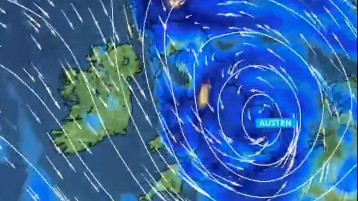
The UK is bracing for significant disruption as the first named storm of the season, Storm Austen, prepares to sweep across the country. Meteorologists have warned that the system is set to undergo “explosive cyclogenesis,” a process known as a “weather bomb,” which will see the storm rapidly intensify as it approaches the coast on Thursday.
North Wales is preparing for a barrage of gale-force winds and torrential downpours. While official weather alerts for the North Wales region have not yet been issued, Met Office projections indicate that heavy rain will begin around 9pm on Thursday, persisting through the night until Friday morning.
Across the rest of the UK, the Met Office has already activated several weather warnings. A yellow wind alert is in place for parts of South Wales from midnight on Thursday until 2pm on Friday. Further south, an amber wind warning has been issued for South West England, spanning 3am to 10am on Friday. Additionally, a yellow rain alert is in effect for parts of Scotland from 6am Friday until 3am on Saturday.
The impact of the storm is expected to escalate throughout Friday morning. Wind gusts are predicted to strengthen significantly, with coastal areas in North Wales likely to see the most severe conditions. Met Office charts show gusts in Holyhead reaching a staggering 63mph by 7am on Friday, with Pwllheli also facing dangerous blasts of around 61mph. Even inland areas, such as Wrexham, can expect gusts reaching 38mph, with winds remaining strong throughout Friday afternoon across the region.
Met Office meteorologist Alex Burkill explained the severity of the incoming system: “Storm Austen will rapidly deepen as it approaches the UK, undergoing a process known as explosive cyclogenesis. Its central pressure is expected to fall by at least 24 hectopascals in 24 hours.”
Deputy Chief Forecaster Tom Crabtree has warned that the storm will bring widespread disruption. “Peak gusts in excess of 70mph are possible on the most exposed coastal areas, while 50-60mph are likely more widely within the warning area,” Crabtree stated.
The public is urged to take extra care during travel and to stay informed, as weather warnings remain under constant review and may be upgraded as the storm tracks closer to the UK. While the worst of the gusts are expected to ease by Friday evening, the combination of heavy rain and high winds is likely to affect transport links and power supplies throughout the day. Residents in affected areas are advised to secure outdoor furniture and monitor local travel updates closely.
Disclaimer: This content is auto-generated for informational purposes only.
Source: Read Original News