






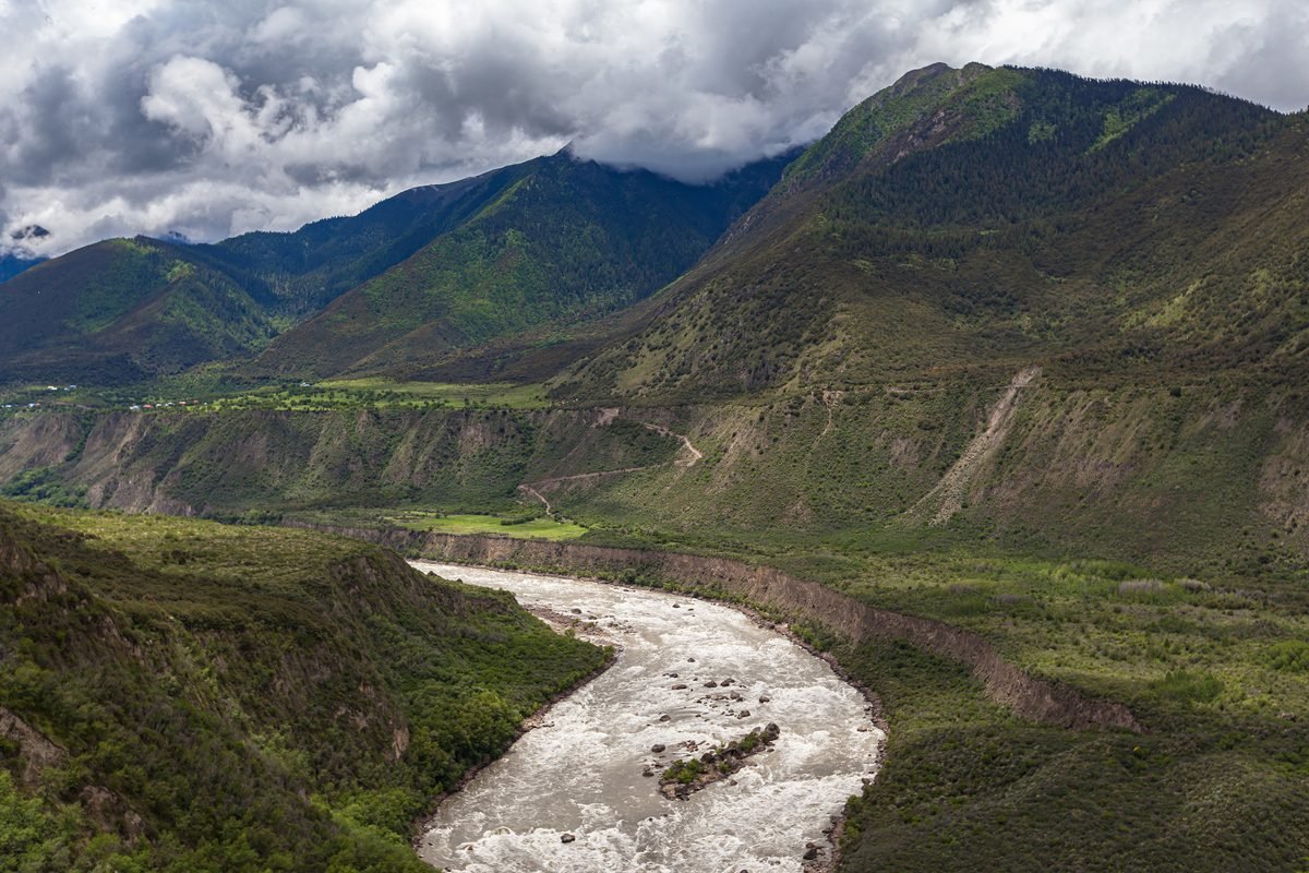
At 823 meters, the Burj Khalifa in Dubai stands as a testament to human engineering, yet it is dwarfed by the sheer scale of the Yarlung Tsangpo Grand Canyon. With a maximum depth of 6,009 meters, one would need to stack seven Burj Khalifas end-to-end to breach the canyon’s deepest point. Averaging 2,268 meters in depth, this formidable geographic feature stretches 505 kilometers across the Tibetan plateau—surpassing the famous Grand Canyon in the United States in both depth and length.
Carved into the eastern edge of the Himalayas, the canyon is defined by the Yarlung Tsangpo River, which holds the record for the highest average elevation of any major river on Earth, sitting at 4,000 meters. Due to its extreme topography and remote location, the canyon remains one of the most pristine and unexplored wildernesses on the planet. Its unique geography creates a rare climatic “ladder,” spanning tropical rainforests and broadleaved woodlands to coniferous forests and alpine tundra.
This immense biological diversity supports thousands of plant species, 230 bird species, and countless reptiles, amphibians, and invertebrates. The canyon serves as a vital refuge for elusive predators, including snow leopards and clouded leopards, which stalk musk deer through the dense foliage. High in the canopy, red pandas and Tibetan macaques find sanctuary, while at higher, craggy altitudes, the rare takin—a stocky, musk-ox-like member of the sheep family—roams the steep slopes. The canyon’s ecological significance is further underscored by the presence of the tallest tree ever discovered in Asia: a Himalayan cypress reaching a staggering 102.3 meters.
The geological origins of this landscape have long been a subject of scientific debate. While once attributed primarily to the erosive power of the river, research published in Science in 2014 suggests that tectonic forces were the primary drivers. Approximately two to two-and-a-half million years ago, rapid rock uplift pushed the Himalayas upward, steepening the gorge and accelerating the river’s cutting power. Today, the river’s path is marked by dramatic serpentine meanders, such as the Guoguotang and Linduo Great Bends, which create isolated islands that foster unique, localized wildlife communities.
As the Yarlung Tsangpo winds toward India—where it becomes the Siang and later the Brahmaputra before reaching Bangladesh as the Jamuna—it acts as a conduit for warm, moist air from the Indian Ocean. This moisture is critical, fueling the lush, forested ecosystems that cloak the canyon walls.
However, the future of this undisturbed wilderness is now at a crossroads. As tourism grows—bolstered by the annual Nyinchi Peach Blossom Festival, which draws visitors to see millions of azaleas and peach trees in bloom—the canyon faces an industrial challenge. In 2025, construction began on the Medog Hydropower Station at the river’s Great Bend.
Billed by proponents as the largest, most ambitious “clean energy” project in human history, the station is scheduled to commence operations in 2033. Critics, however, warn that the dam will irrevocably alter the river’s natural flow, disrupt sediment transport, and jeopardize the canyon’s delicate, high-altitude ecosystems. Beyond the environmental impact, the project has ignited international tensions. India and Bangladesh have expressed significant concerns regarding water security, fearing that the upstream control of such a vital waterway could destabilize downstream agriculture and ecosystems that support millions of people. As the world watches, the Yarlung Tsangpo Grand Canyon remains caught between the promise of renewable power and the preservation of an unparalleled natural treasure.
Disclaimer: This content is auto-generated for informational purposes only. It has been rewritten and paraphrased from the original source.
Source: Read Original News