







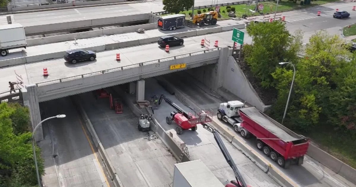
For commuters navigating the bustling hub of Dearborn, Michigan, the intersection of Michigan Avenue and Telegraph Road has become a daily endurance test. What was intended to be a manageable infrastructure project has transformed into a long-term bottleneck, with officials confirming this week that construction delays will persist well beyond the original completion date.
While the physical asphalt and concrete remain the focus of frustrated drivers, the situation highlights a growing reliance on real-time data integration. As road projects become increasingly complex, the intersection of civil engineering and traffic-management technology is becoming more vital than ever for motorists attempting to sidestep the congestion.
## Navigating the Gridlock with Smart Tech
In an era where infrastructure updates move at a glacial pace compared to the speed of software development, residents are increasingly turning to Google Maps and Waze to mitigate the impact of the Dearborn delays. The current situation at Michigan and Telegraph serves as a case study for why tech giants are doubling down on AI-driven navigation.
Google’s latest updates to its mapping ecosystem are designed to handle exactly these types of scenarios. By utilizing aggregated, anonymized location data from millions of Android users, Google Maps can detect a slowdown in real-time, even before road sensors register a change in flow. For a driver sitting at a dead stop near Telegraph Road, these systems provide critical, second-by-second re-routing suggestions. As road work extends into the coming months, the reliance on these predictive models will only grow, as commuters look for “smart” alternatives to the main thoroughfares that have been crippled by orange barrels and lane closures.
## The Role of AI in Urban Infrastructure
Beyond simple turn-by-turn directions, the construction delay underscores a broader trend in the tech industry: the shift toward AI-powered city planning. Google’s “Project Green Light,” for instance, is an initiative that uses AI to analyze traffic patterns at urban intersections. By leveraging the same data that powers Google Maps, the company assists city engineers in optimizing traffic light timing to reduce stop-and-go patterns.
While the Dearborn intersection currently requires physical construction, the tech industry is pushing for a future where such delays are managed more efficiently through simulation. Digital Twin technology—where a virtual replica of a city’s transit system is built—allows developers to run thousands of traffic simulations. These models can predict how a closure at a major intersection will impact surrounding neighborhood streets, allowing for better management of traffic flow before the first shovel hits the dirt. If this technology were fully implemented at the municipal level, it could potentially shorten the duration of projects by identifying bottleneck risks before construction begins.
## Future-Proofing the Daily Commute
The frustration in Dearborn is a stark reminder that even as we move toward an age of autonomous vehicles and intelligent infrastructure, the physical realities of road work remain a significant hurdle. However, the integration of real-time cloud computing and AI updates means that the “cost” of these delays—in terms of time and fuel—is being managed more effectively than in previous decades.
As Dearborn officials scramble to manage the extended timeline, the tech industry is simultaneously iterating on how it communicates these changes. Google is constantly refining its “incidents” feature, allowing users to report construction hazards or lane closures in real-time. This crowdsourced data, when combined with AI verification, ensures that the digital map remains the most accurate representation of the physical road.
For the people of Dearborn, the road ahead remains blocked for the time being. However, by leveraging the latest updates in navigation and machine learning, commuters can at least ensure they are spending less time idling in traffic and more time moving toward their destinations. As infrastructure projects continue to evolve, the partnership between local government and tech platforms will remain the primary buffer between city residents and the inconvenience of urban development.
Disclaimer: This content is auto-generated for informational purposes only.
Source: Read Original News